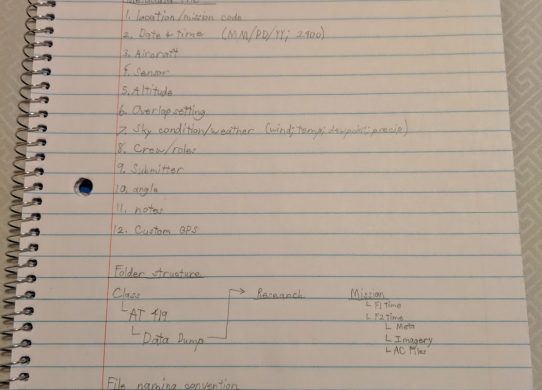
File Structure Organization – UAS Capstone Part 1
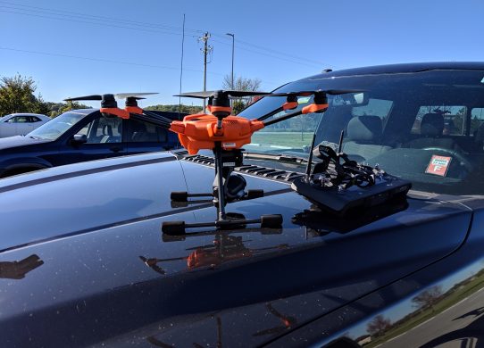
The semester has officially started and with that comes all of the prep work needed for the project to be successful. The Matrice…
The semester has officially started and with that comes all of the prep work needed for the project to be successful. The Matrice…

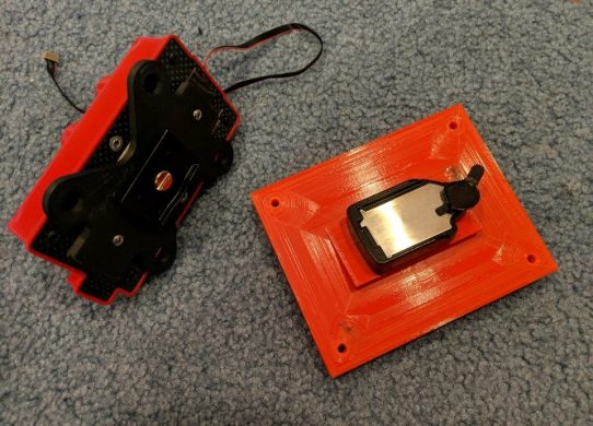
In my previous post, I was finishing off the camera mounts and other components to attach the Red Edge to the frame. The…
Before going on break, I agreed to take on a small project so we can hit the ground running with a working aerial…

After meeting as a class over the past few weeks, it became apparent that we would all get the most out of the…
When dealing with data gathered from UAS, one common issue that first responders will run into is the limitation of how long it…
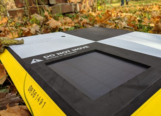
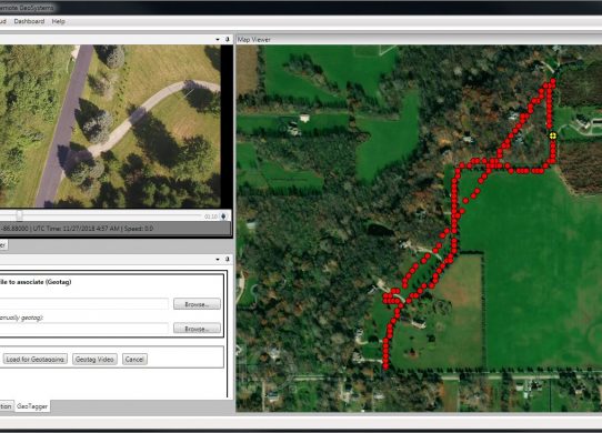
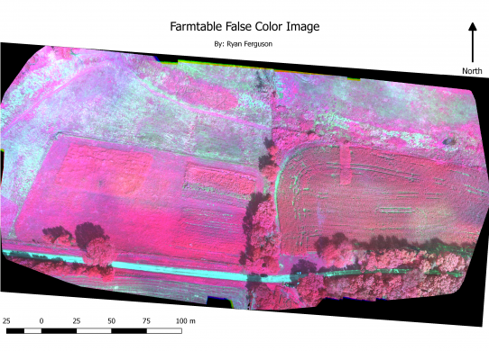
When doing flights for gathering data, ground control points are critical for drawing conclusions from the data gathered. They are targets placed at…
When deciding my research project, I had to begin the required literature reviews for writing my paper. This primarily involves creating an annotated…
On November 1, Purdue hosted its annual GIS Day. the event was originally started by ESRI to promote the use of GIS but it…
When flying drones for data gathering missions, one issue that comes up quite often is the Line of Sight, or LOS, rule which…
Continuing the lab from a week ago when I started using ArcGIS and ArcScene, I attended a workshop hosted by Dr. Christina Hupy…