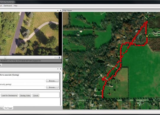
Geospatial Video
When dealing with data gathered from UAS, one common issue that first responders will run into is the limitation of how long it…
When dealing with data gathered from UAS, one common issue that first responders will run into is the limitation of how long it…
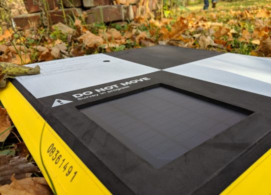
When doing flights for gathering data, ground control points are critical for drawing conclusions from the data gathered. They are targets placed at…

When deciding my research project, I had to begin the required literature reviews for writing my paper. This primarily involves creating an annotated…
On November 1, Purdue hosted its annual GIS Day. the event was originally started by ESRI to promote the use of GIS but it…